INTERIOR LiDAR SCANNING AND 3D VIRTUAL TOURS
We combine precise interior LiDAR scanning with immersive 3D virtual tours to turn spaces into accurate, navigable digital twins.
Our workflow captures detailed spatial data and high-resolution imagery, producing photorealistic walkthroughs, measurable floorplans, and point-cloud models useful for design, facility management, real estate, and preservation.
Interior Precision: LiDAR Scanning & Digital Twins
While our drone fleet captures the world from above, our RealSee Galois Laser Scanner brings that same high-level precision indoors.
By integrating professional-grade LiDAR scanning into our workflow, we transform physical spaces into rich, intelligent digital assets.
Whether you need a rapid site survey for a new project or a high-end virtual showcase, we provide the data you need to design, build, and market with confidence.
Our Interior Data Services
We don’t just capture points; we create usable solutions. Our RealSee Galois technology allows us to deliver:
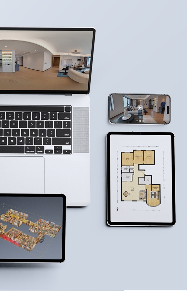
Scan to Plan
Rapidly generate highly accurate 2D floor plans and site layouts from 3D data.
Create Revit-ready models that serve as a “true-to-life” foundation for architectural and engineering workflows.
Scan to BIM
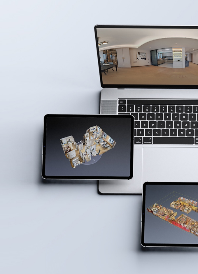
Scan to 3D Model
High-fidelity mesh and CAD models for renovation, interior design, and spatial analysis.
Immersive, 8K-resolution walkthroughs that allow stakeholders to navigate a space remotely with stunning clarity.
3D Virtual Tours
Experience the
Indoor and Outdoor
Virtual Tour
A 3D virtual tour for interior design offers an immersive, photo-realistic walkthrough that allows clients and designers to explore spatial layouts, materials and lighting before any physical work begins.
By navigating a detailed digital model, stakeholders can assess scale, sightlines and circulation, test different finishes and furniture arrangements, and identify potential issues early — saving time and cost while improving design decisions.
Interactive annotations, measurement tools and staged scenes enhance communication and make it easier to present concepts to clients, contractors and planning authorities.
Our Equipment
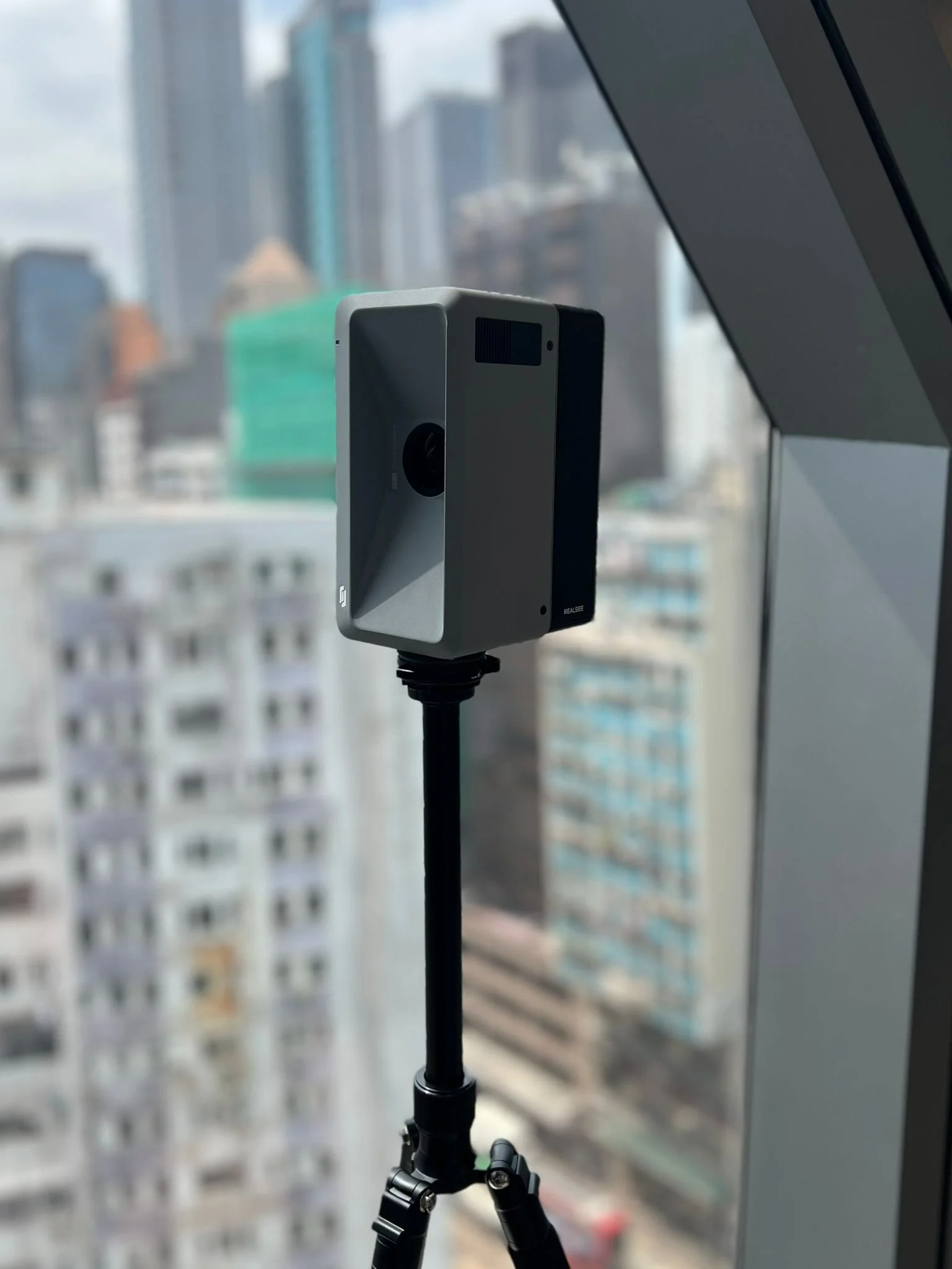
By leveraging the RealSee Galois alongside our existing drone expertise, we offer a “Total Reality Capture” solution:
Speed & Accuracy:
We can capture an existing space in a fraction of the time required by traditional manual measurements, reducing site visits and human error.
Internal Project Efficiency:
We use this technology on our own projects to ensure our designs are built on a perfect digital foundation.
A Unified View:
In collaboration with our sister company, Hokkaido Drone Services (HDS), we can merge indoor LiDAR data with our aerial DJI Matrice 350RTK scans to provide a seamless digital twin—from the property boundary to the interior finishes.