
HOKKAIDO DRONE SERVICES
digital drone survey modeling , mapping, and more.
HDS employs high end DJI equipment and state of the art software for ultimate accuracy and efficiency to produce our data and models to aid in the planning and decision making of your development.
"Before anything else,
preparation is the key to success."
— Alexander Graham Bell
Our Services
Professional operators and unmanned aerial vehicles to capture high-resolution imagery, gather geospatial data, or perform specialized aerial tasks. Instead of purchasing expensive hardware and training pilots internally, our Drone as a Service (DaaS) model increases project safety, accelerates data collection, and reduces costs, to get your project progressing sooner.
Drones & Data
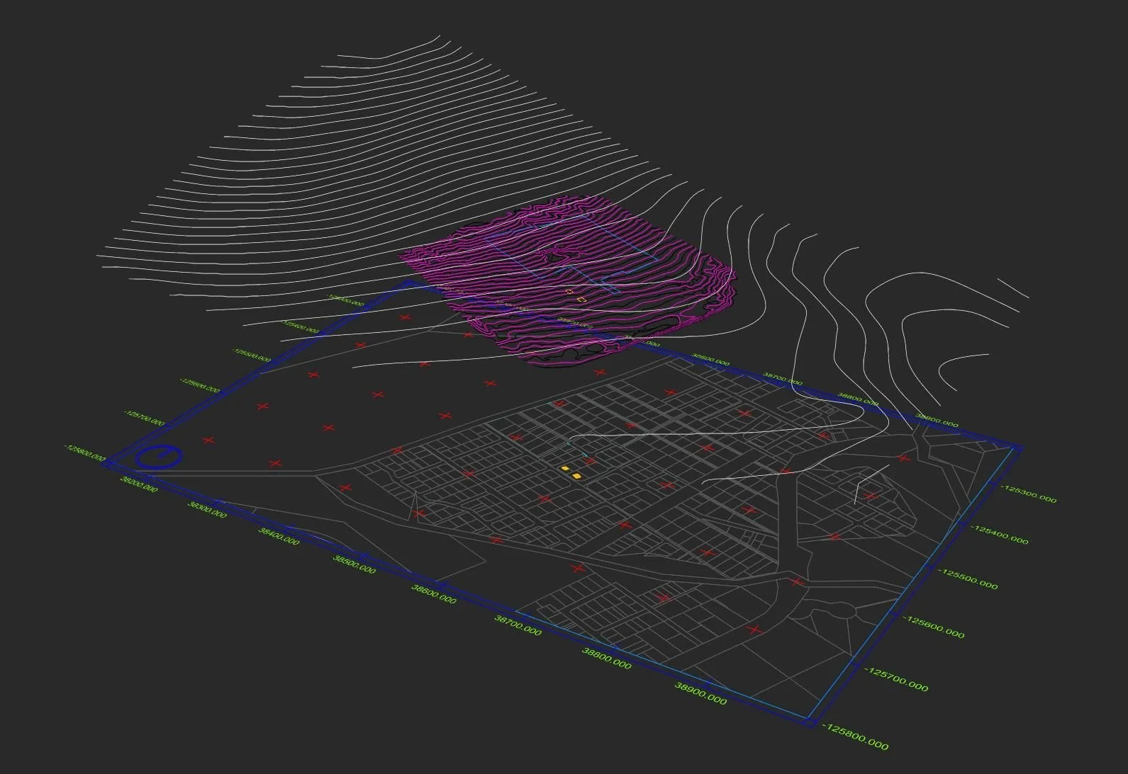
Site Analysis
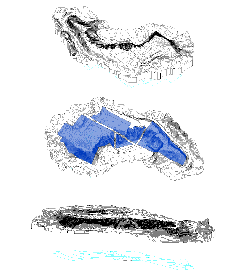
We provide refined digital files assisting in the development, planning, and decision making process. For use by architects and engineers in CAD software, including - Combined CAD models - detail contour line representations - Elevation heat maps - Elevation sections - Sun-path animations - 3D models.
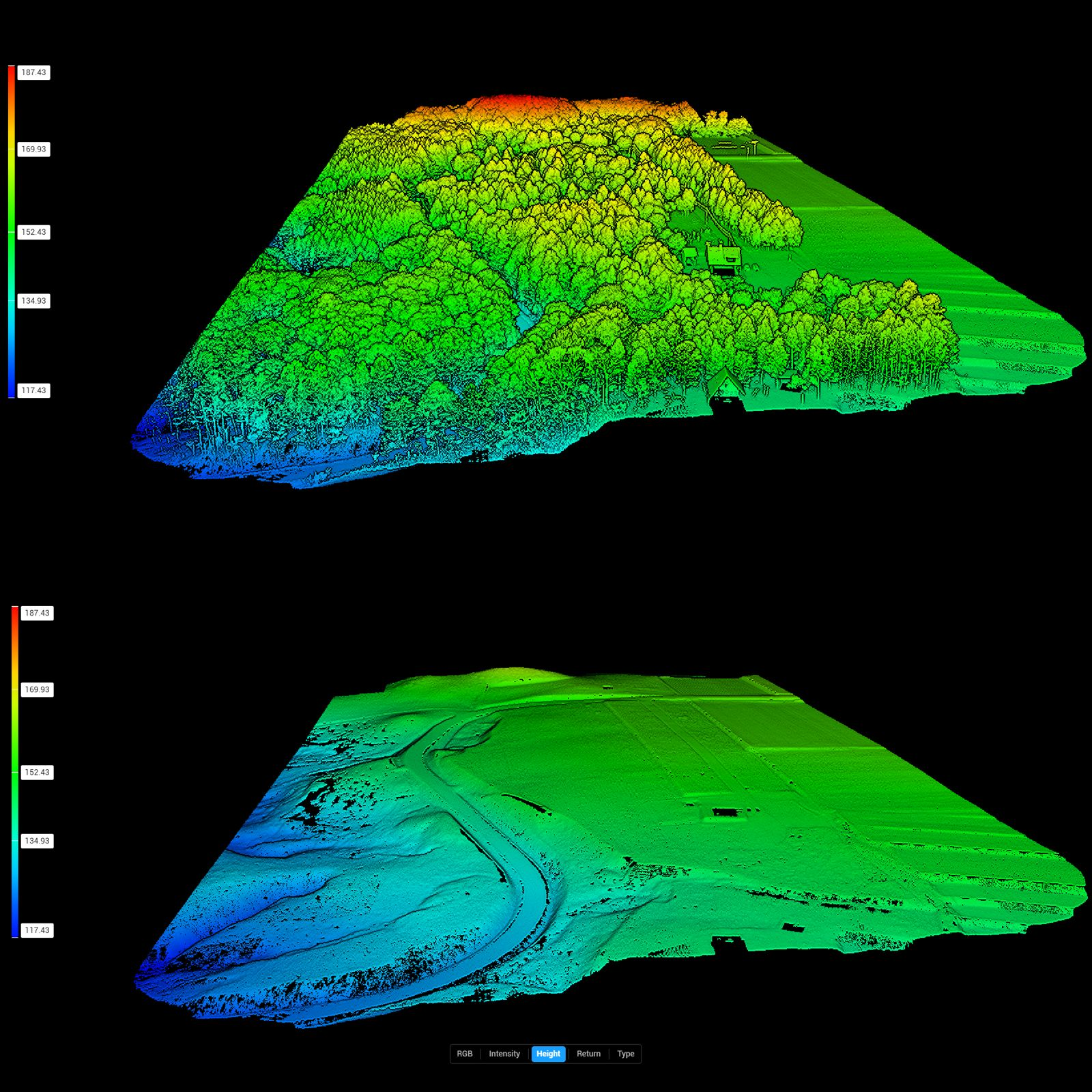
LiDar Capability
HDS utilises hi-tech sensors to penetrate tree foliage for accurate surface modelling, enabling accurate planning without the traditional costs and more time efficient, prior to breaking ground.
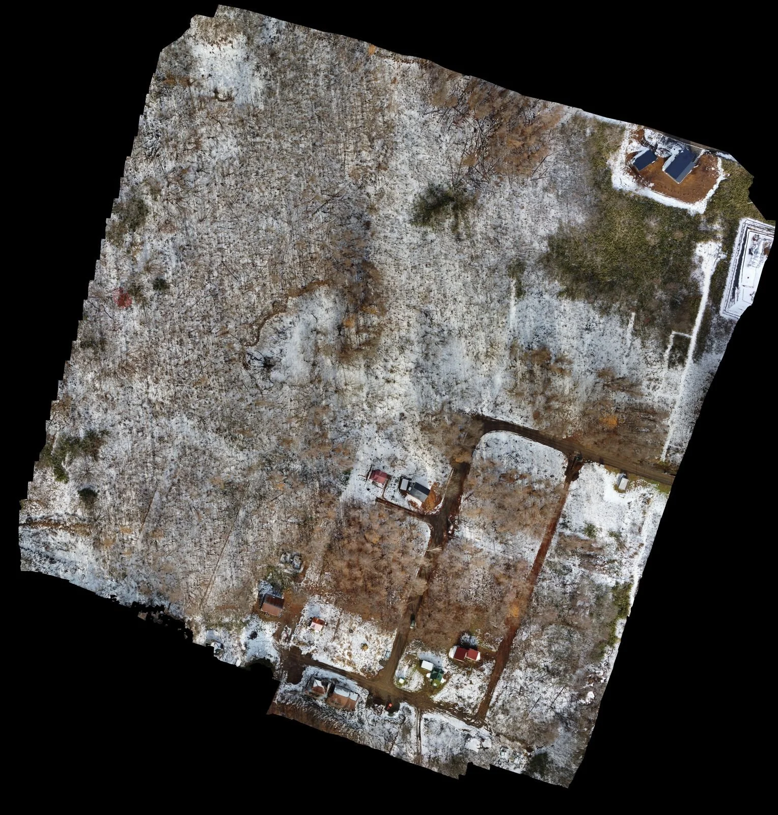
Orthomosaics
Detailed high resolution plan images, geo referenced with measurements, to assist in development planning and marketing material.
Architecture & Development
HDS can build on our foundation survey data to develop full architectural plans, working with our clients to best utilise a site to desired functionality and needs. We also monitor progress of construction to keep you updated remotely.
Construction Progress
Keep a record of you build, or if out of town keep updated with internal and external models, aerial imagery and video during this exciting time.
Uploaded to your own personal portal.
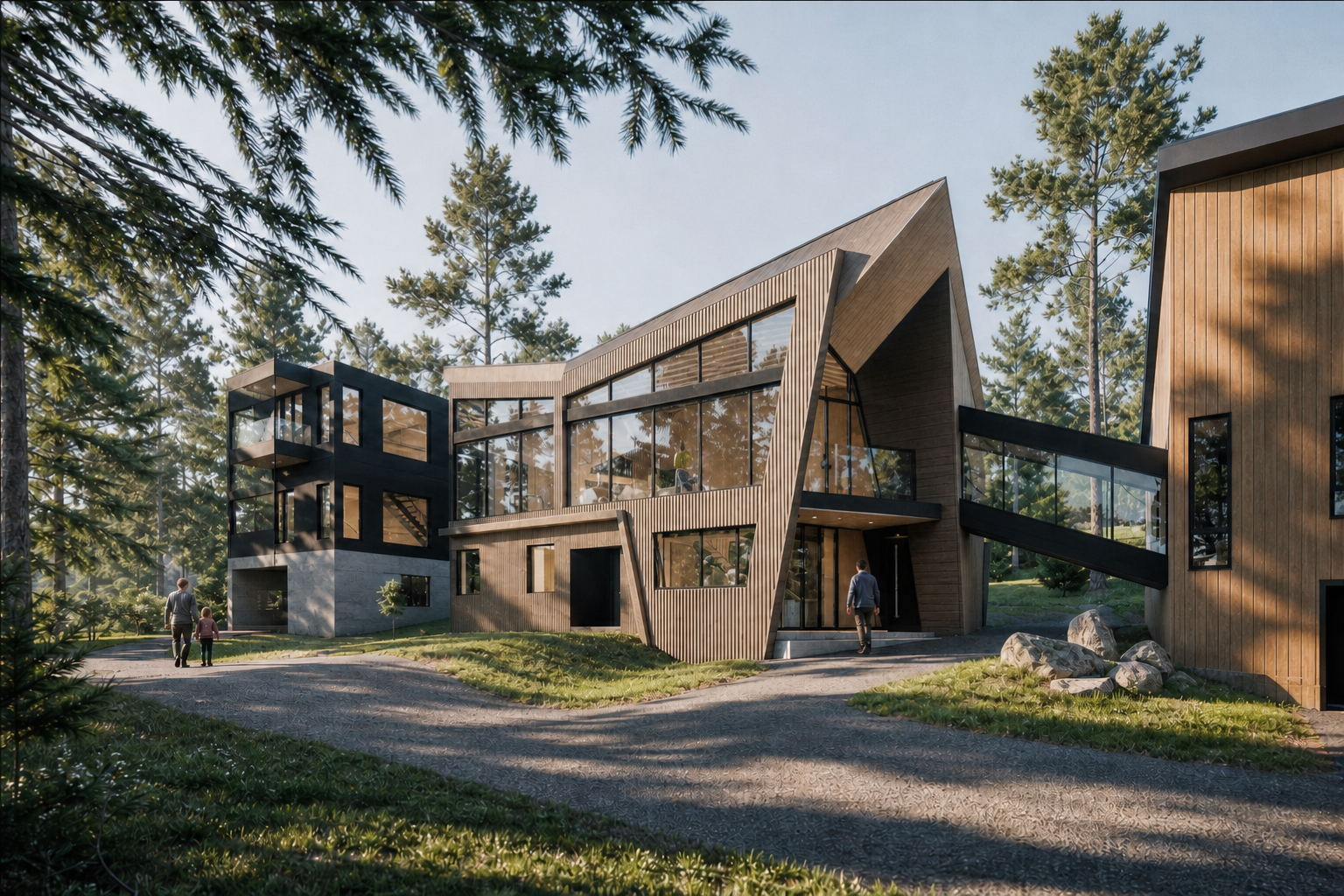
Concept Architecture
Unsure of what is possible do do with your site? Our partners can design a single home or entire development, based on budget, to take advantages of unique terrain features and the most aesthetic views of the area. Consideration given to sun paths, and living in a winter environment.

Model 3D Printing
HDS has the capability to manufacture a 3D print of your land in contour form, or accurate representation of your home or building. A unique model to aid development ideas or a show piece for display.
Our Reports
HDS delivers consistently high-quality, professionally produced aerial data tailored to each project, combining precise surveying, detailed mapping and accurate 3D modelling to meet rigorous technical standards.
Our team ensures comprehensive coverage and robust data density, providing essential measurements, georeferenced imagery and actionable insights that support confident decision-making throughout design, construction and asset management phases.
Each deliverable is quality-assured, formatted for seamless integration with industry workflows and accompanied by clear documentation to maximise usability and value for clients.
Products
Orthomosaics, DEMs, DSMs, CAD, Analysis, Contours, Heat maps, Models, Context sheets, Terrain features, Full drawing sets, Renderings, Survey docs, Detailed sections, Boundary and height data, plus more.
While our drone fleet captures the world from above, our RealSee Galois Laser Scanner brings that same high-level precision indoors.
By integrating professional-grade LiDAR scanning into our workflow, we transform physical spaces into rich, intelligent digital assets.
Whether you need a rapid site survey for a new project or a high-end virtual showcase, we provide the data you need to design, build, and market with confidence.
Interior Precision: LiDAR Scanning & Digital Twins
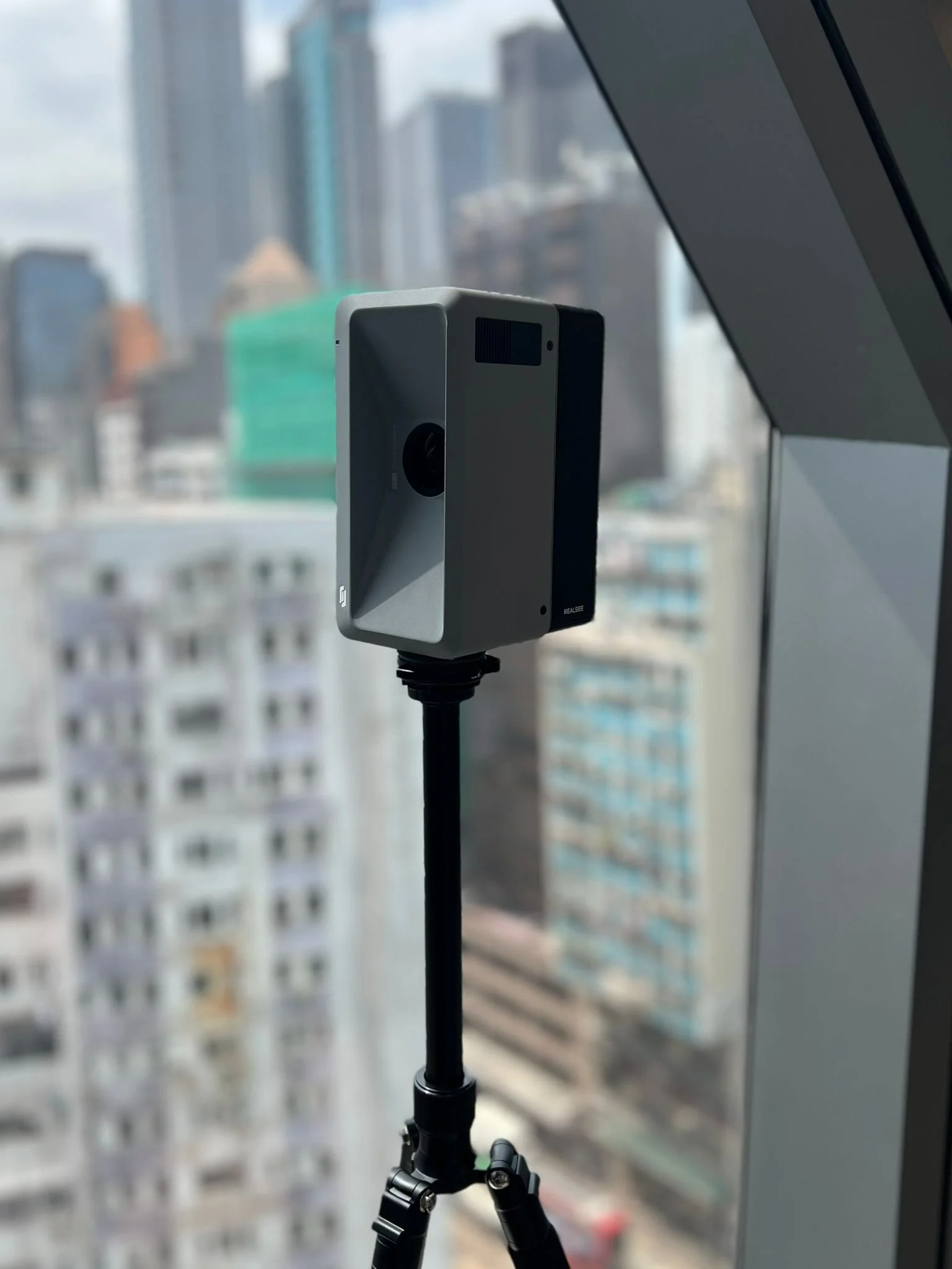
Scan to Plan, Scan to BIM, Scan to 3D Model, 3D Virtual Tours.
Our Equipment
HDS employs only top-quality drones and advanced aerial systems, combining cutting-edge sensors, stabilisation and imaging technology, combined with the best software to deliver consistently high-resolution, professional data and files compatible with professional CAD and design programs.
Every piece of equipment is chosen for reliability, precision and ease of integration into complex projects, ensuring clients receive accurate data, superior visual output and efficient operations regardless of environmental conditions.
MATRICE 350 RTK
sets a new benchmark for the industry
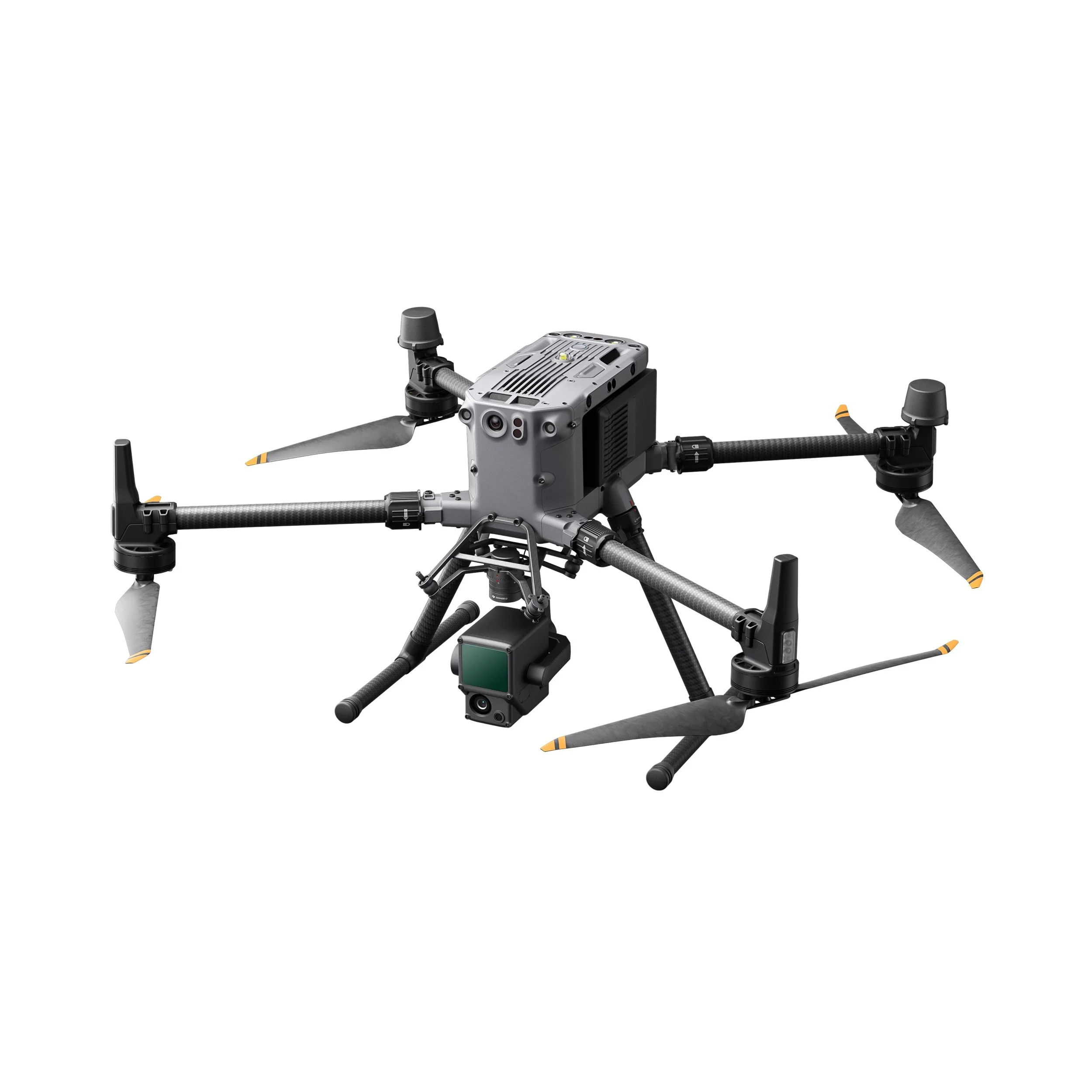
This next-generation drone platform features an all-new video transmission system and control experience, a more efficient battery system, and more comprehensive safety features, as well as robust payload and expansion capabilities.
It is fully powered to inject innovative strength into any aerial operation.
ZENMUSE L2
Integrated LiDAR Solution
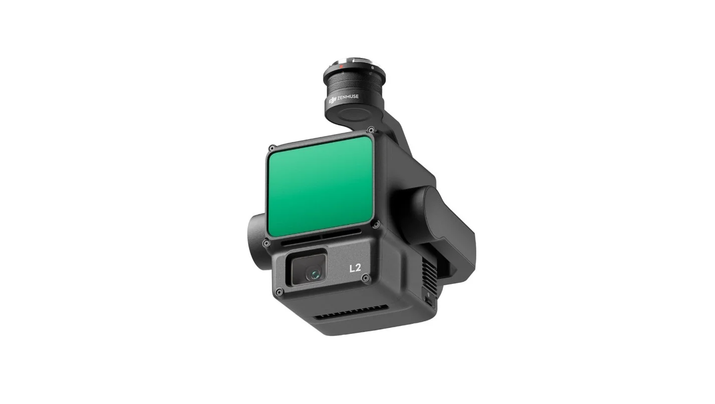
Supported by its powerful hardware, L2 can allow for a precise scan of complex subjects within an extended range and faster point cloud acquisition. During operations, users can preview, playback, and process point cloud models on-site, with Task Quality Reports generated by DJI Terra, offering a simple, one-stop solution to improve overall efficiency.
This enables users to achieve high-precision point cloud results with one-stop post-processing.
MAVIC 4 PRO
Cinematic Flying Camera
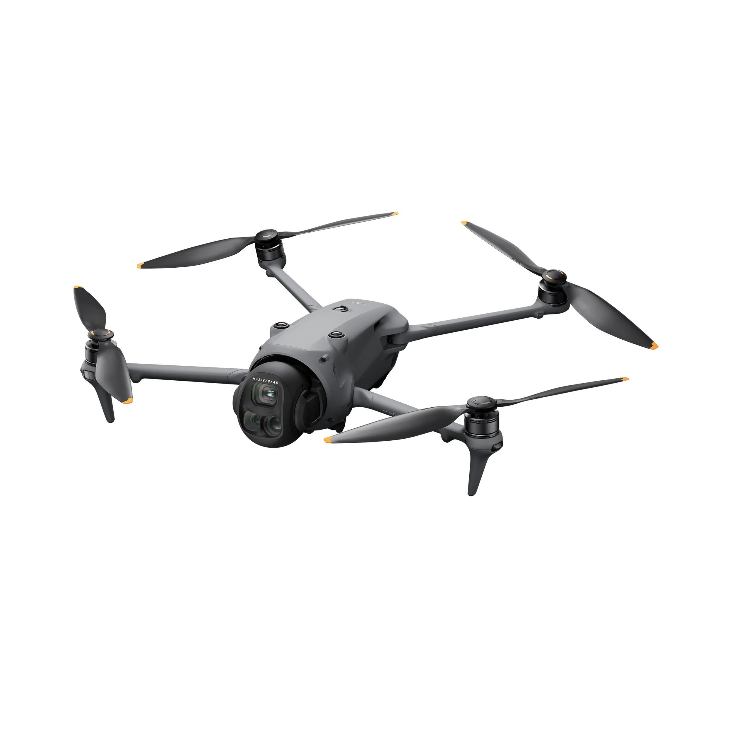
Triple Camera System:
It includes a Hasselblad main camera with a 4/3 CMOS sensor and 100 MP resolution capable of recording 6K HDR video at 60 fps.
It is flanked by two telephoto lenses with 1/1.3″ (70 mm medium telephoto) and 1/1.5″ (166 mm f/2.8 telephoto, 50 MP) CMOS sensors respectively.
AVATA 2
FPV High Speed Drone
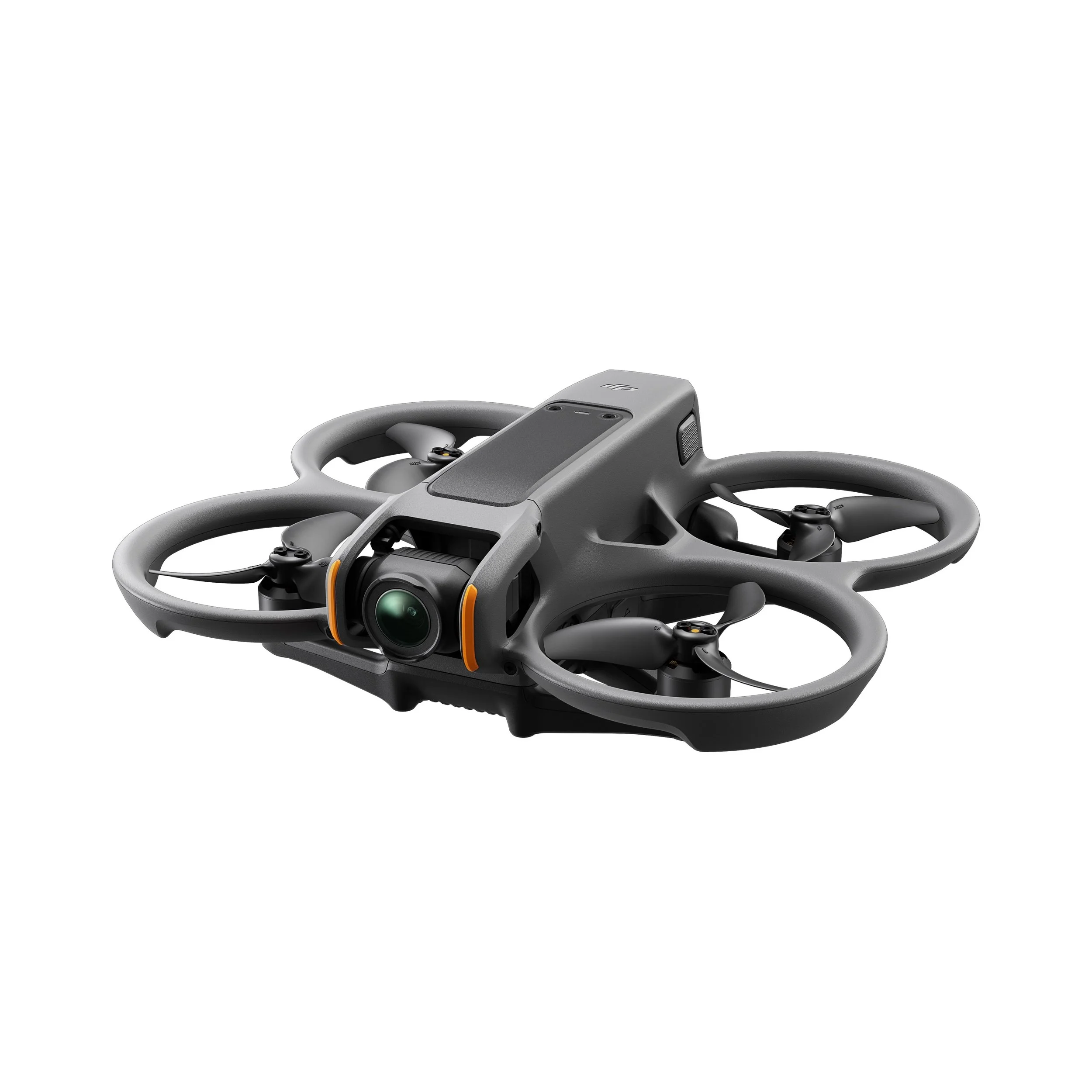
DJI's benchmark "cinewhoop" FPV (First-Person View) drone, designed to offer a fully immersive flight experience for professional video results.
It mounts a 1/1.3-inch CMOS sensor that records 4K video at 60fps HDR. It supports the 10-bit D-Log M color profile for greater flexibility during editing (color grading).
YOUR DATA,
OUR PRO DELIVERABLES
White Label Our Product
Hokkaido Drone Services delivers comprehensive reports, refined imagery and data files, and a full range of aerial services tailored to your project needs.
We provide professionally formatted deliverables—inspection reports, orthomosaics, DEMs, 3D models and LiDAR derivatives—branded with your logo and corporate identity, or supplied under HDS branding as required.
Our outputs are quality‑checked, geo‑referenced and supplied in industry‑standard formats for easy integration into your workflows.
OUR TECHNICAL PARTNERS

Architecture & Design firm
based in Hong Kong.

Interior and Product Design studio based in Italy.

World leading manufacturer of commercial drones.
Book a consultation
Inquire or book your appointment today and entrust your work to experienced professionals in the field. We guarantee timely and quality service, carefully attended to in every detail to meet all your needs.
