
Frequently Asked Questions
Can’t find the correct answer to your question?
"Before anything else, preparation is the key to success."
- Alexander Graham Bell
-
What is a drone LiDAR survey and what advantages does it offer over traditional photogrammetry? LiDAR (Light Detection and Ranging) technology uses laser pulses to measure distances with millimeter precision. Unlike conventional photogrammetry, LiDAR can penetrate dense vegetation and tree canopies. This enables it to capture the true terrain profile (Digital Terrain Model - DTM) even in densely forested or rugged areas where optical photogrammetry fails.
What level of accuracy can be achieved with the generated 3D terrain models? By combining high-sensitivity LiDAR sensors with RTK/PPK positioning systems and Ground Control Points (GCPs), we achieve centimeter-level accuracy (often within 2–3 cm across all axes). The resulting data meets the strict standards required for engineering, infrastructure, and cadastral applications.
How do architects, engineers, and contractors use the survey reports? Our reports provide a comprehensive data foundation for design and construction phases. They enable accurate elevation analyses, earthwork (cut and fill) volume calculations, hydrological and slope risk evaluations, and seamless integration into BIM/CAD workflows, significantly reducing planning errors and site delays.
-
Our reports, and files, provide a comprehensive data foundation for design and construction phases. They enable accurate elevation analyses, earthwork (cut and fill) volume calculations, civil works (roads, plumbing, drainage) hydrological and slope risk evaluations. Seamless integration into BIM/CAD workflows, significantly reducing planning errors and site delays, and provide accurate data for your design team to build on.
-
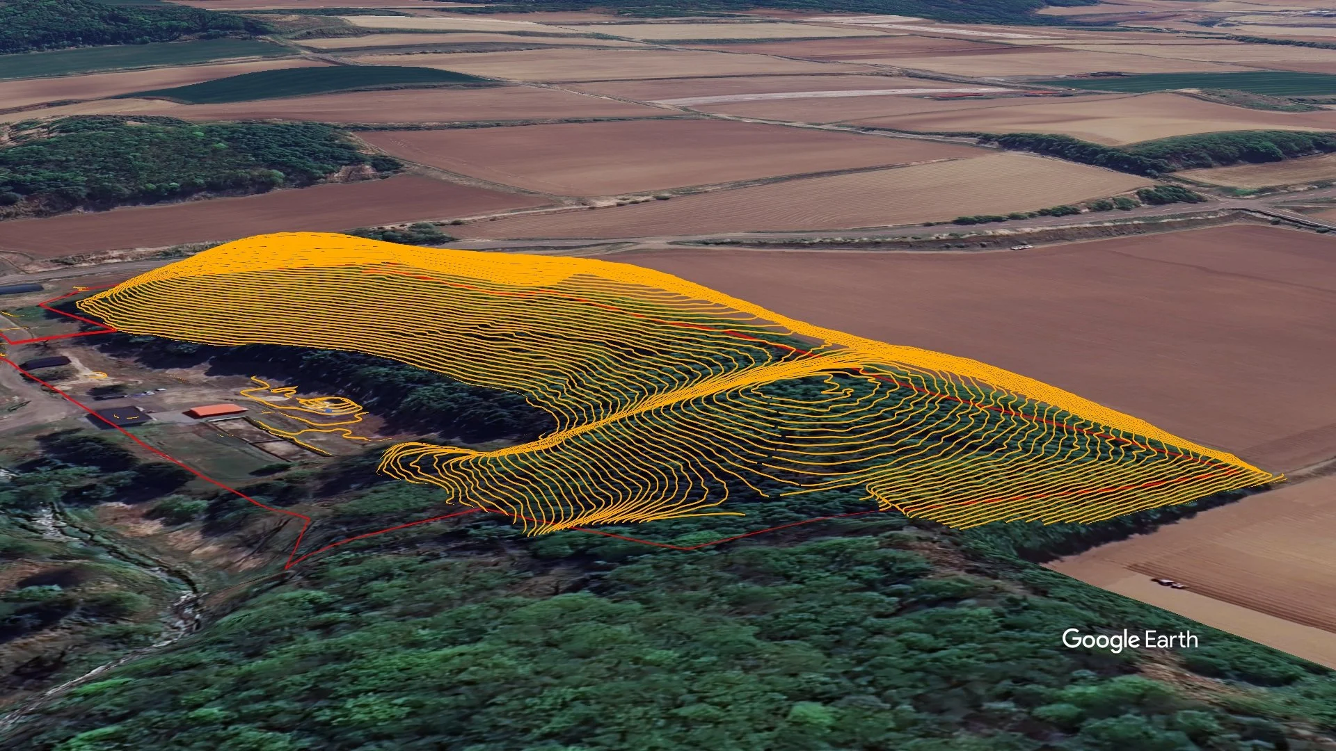
Contour maps are generated directly from the bare-earth DTM point clouds. Lines connecting points of equal elevation are produced at customizable intervals (e.g., 0.25 m, 0.5 m, 1 m). These maps are essential for land developers, civil engineers, and architects to quickly evaluate slope steepness, natural drainage paths, and grading , and ultimately foundation requirement's. Knowing the features of the plot can save significant sums of money, and time, in planning where you will build.
-
What is the difference between DEM, DTM, and DSM?
DEM (Digital Elevation Model): The overall term for digital representations of terrain elevations.
DTM (Digital Terrain Model): A bare-earth model where all natural and man-made structures (such as trees, vegetation, and buildings) are digitally filtered out. It reflects only the bare ground surface.
DSM (Digital Surface Model): Captures both the natural ground and all above-ground features, including vegetation tops, buildings, bridges, and power lines.
How are Elevation Contour Line Maps generated and how are they used? Contour maps are generated directly from the bare-earth DTM point clouds. Lines connecting points of equal elevation are produced at customizable intervals (e.g., 0.25 m, 0.5 m, 1 m). These maps are essential for land developers, civil engineers, and architects to quickly evaluate slope steepness, natural drainage paths, and grading requirements.
-
What is a 3D Mesh model and how is it derived from point cloud data? A 3D Mesh is created by connecting the discrete points of a LiDAR or photogrammetric point cloud into a continuous triangular network (TIN - Triangulated Irregular Network). A high-resolution texture map derived from aerial photography can then be projected onto the mesh, producing a highly accurate, watertight 3D digital twin of the site or asset.
How are 3D Meshes utilized in architecture and civil engineering? 3D Meshes allow project stakeholders to perform interactive virtual site walkthroughs, measure distances and surface areas directly in 3D space, detect spatial clashes between existing structures and proposed designs, and present visually compelling digital twins to clients and regulatory bodies.
-
What is 3D Gaussian Splatting and how does it differ from traditional 3D Meshes? 3D Gaussian Splatting is a cutting-edge radiance field technique for reconstructing 3D environments using spatial Gaussian functions. Unlike traditional polygonal meshes, Gaussian Splatting preserves fine details, reflections, transparency, and complex geometry, resulting in photo-realistic real-time rendering and immersive scene exploration.
In which scenarios is Gaussian Splatting recommended? It is ideal for digital heritage preservation, complex architectural asset documentation, high-end real estate virtual tours, and public presentation materials where photo-realism and visual fidelity are critical.
-
How are drone surveys integrated with high-end architectural renderings? We use the precise LiDAR terrain model and 3D mesh as an exact real-world baseline (Matchmoving / Camera Tracking). Proposed architectural CAD/BIM models are then placed within this true-to-scale environment, applying photorealistic lighting, materials, and atmospheric effects to showcase the visual impact of the design within its actual surrounding landscape.
What is the difference between survey models and architectural renderings? Survey models (LiDAR, DTM, Splatting) depict the existing condition of a physical site. Architectural renderings are high-definition graphical visualisations representing future designs or proposed modifications overlaid onto or integrated with the existing site data.
-
You can reach us directly via the contact form on our website at https://www.hdsjapan.com/. Please provide the location of the target area, estimated size in hectares or square meters, and required deliverables. Our technical team will review your inquiry and respond within 24 to 48 hours.
-
We deliver a whole range of files for your and your teams use, including:
Analysis vector and survey data PDF, architectural compatible DXF and DWG, GeoTIFF (.TIFF) maps, ESRI Shapefiles (.SHP), OBJ, and more specialised point clouds (.LAS, .LAZ), geospatial raster and vector datasets.
We also provide video , jpeg, various animations, and photorealistic concept imagery