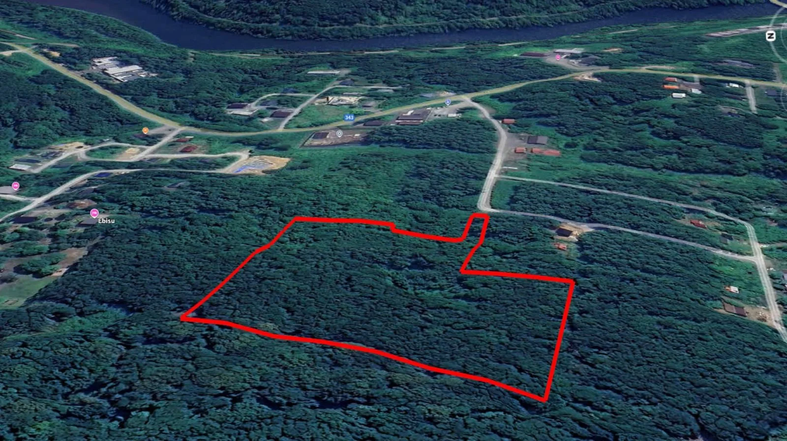
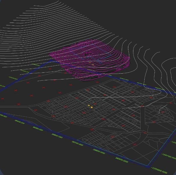
Site Analysis
We provide refined digital files assisting in the decision making process, and for use by Architects and engineers in CAD software. These include - Contour line representations - Elevation heat maps - Elevation sections - Sun-path animations - 3D models.
OUR TECHICAL PARTNERS

Area Pricing from 0 to 250,000 sqm
Origami:
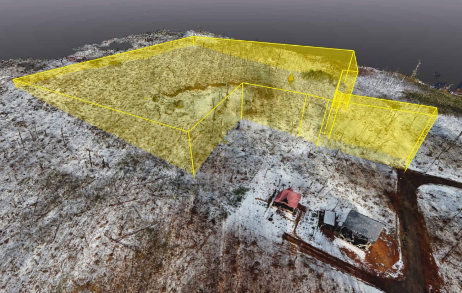
Gaussian Splatting 3D Model
The 3D Gaussian Splatting model is a technique used to represent and render three-dimensional scenes by approximating complex geometry and textures with a collection of Gaussian functions, or "splats." Each Gaussian splat is defined by parameters such as position, covariance, color, and opacity, which collectively contribute to a smooth, continuous representation of surfaces and volumetric details. This method enables efficient and realistic rendering of 3D environments by blending these splats, allowing for high-quality visualization with reduced computational complexity compared to traditional polygonal meshes. Gaussian splatting is especially useful in applications like real-time rendering, volumetric reconstruction, and augmented reality.
Releasee Test:
Interior Design
Virtual Tour
A 3D virtual tour for interior design offers an immersive, photo-realistic walkthrough that allows clients and designers to explore spatial layouts, materials and lighting before any physical work begins. By navigating a detailed digital model, stakeholders can assess scale, sightlines and circulation, test different finishes and furniture arrangements, and identify potential issues early — saving time and cost while improving design decisions. Interactive annotations, measurement tools and staged scenes enhance communication and make it easier to present concepts to clients, contractors and planning authorities.