Yunosato
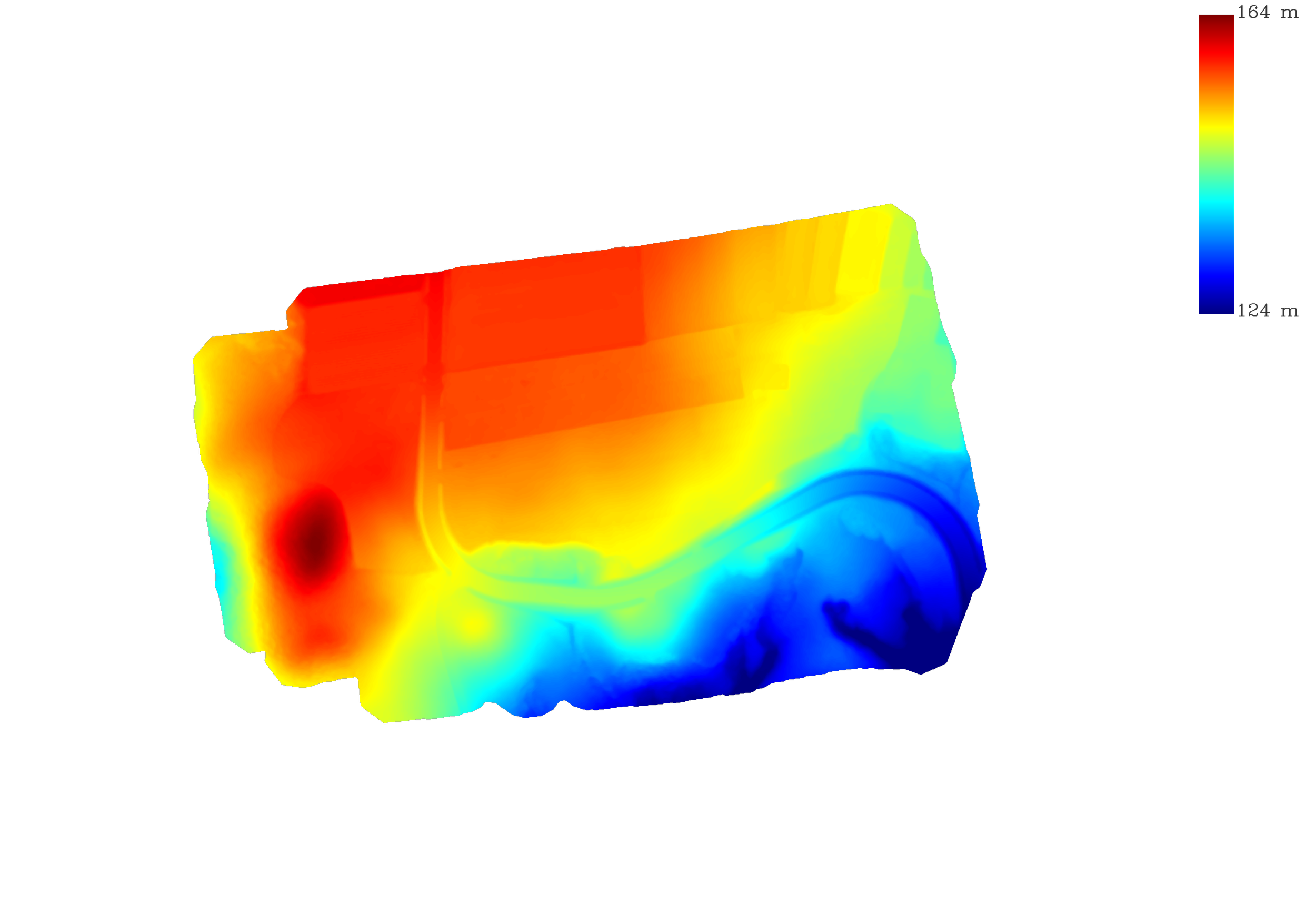
Heavily covered in trees and thick undergrowth particularly to the southern side of the plot, HDS was able to build precise models for identifying and analysing terrain features without the very time consuming and costly process of removing this growth. This enabled the client to assess the work requirement, and refine the design to to produce a cost effective development, early in the planning stage.
Tasks Perfomed
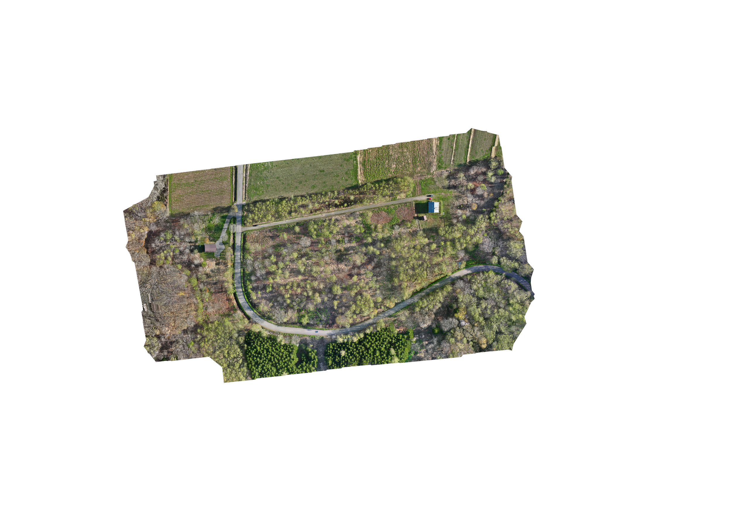
Area Mapping (Orthomosaic images)
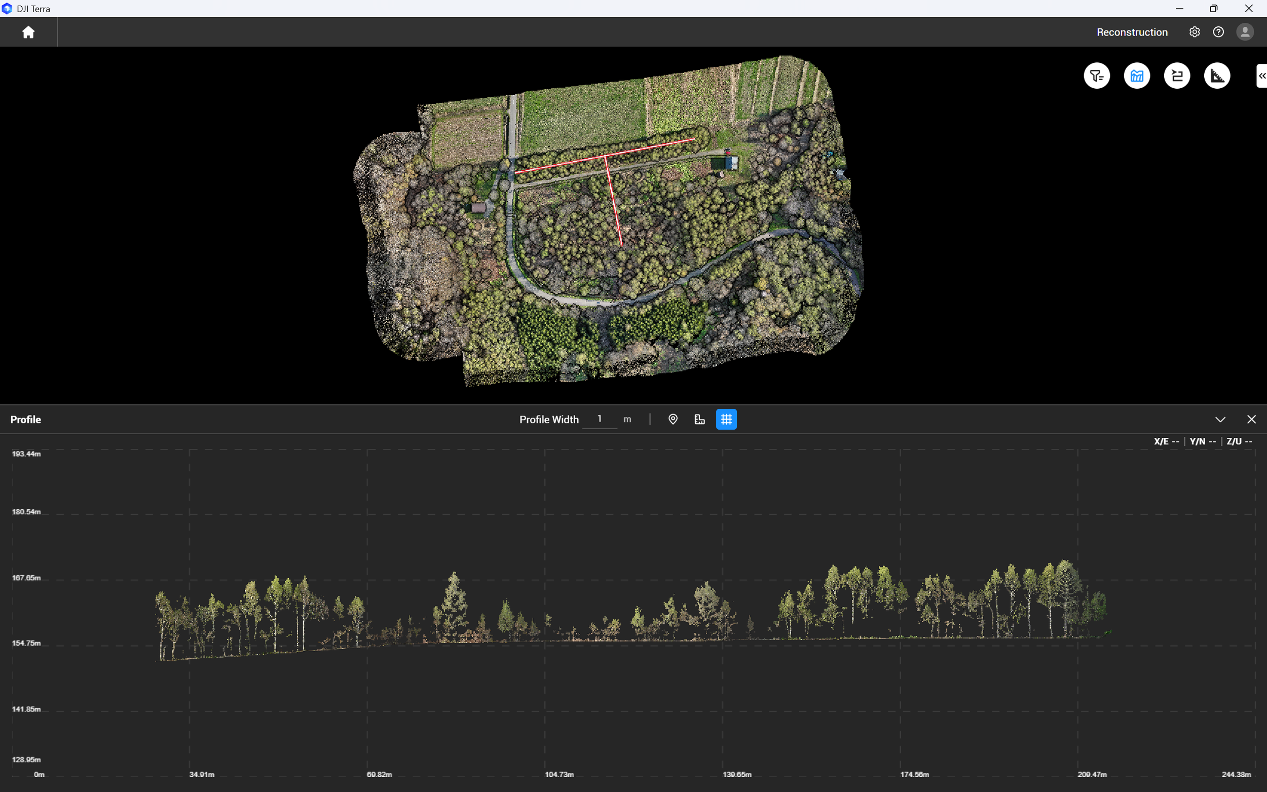
Lidar Scanned model production
Site Analysis
Section data
Sun-path and 3D model videos
Aerial Photography
Full CAD deliverable package